

For years it was too expensive to leave the demo tent. Now the cost of lidar competes with radar, while also being able to see pedestrians and penetrate through rain and snow better than video. A tipping point has arrived at the intersection. Tom Stone takes a look at some of the US deployments leading the way for a new era in safety and traffic management
Infrastructure lidar has long demonstrated impressive results at intersections, it counts everything, it protects pedestrians, and then someone asks the price and the conversation ends.
That is no longer the case. The sensors are going up by the hundred, the agencies budgeting for them are talking in terms of entire networks rather than showcase corners, and the reason is simple – cost.
“For decades we’ve used radar at intersections to help us monitor what’s going on,” says Blaine Leonard, transportation technology engineer at Utah DOT. “In the last few years, we’ve discovered that lidar can do the same thing with better granularity, better understanding of exactly what’s going on, and although this wasn’t true four years ago, it is now at the same price as radar.”
It is the tipping point the industry has been waiting for, moving the superior sensor from pilot-project argument to procurement default. “It’s now deployable and scalable, and there are a number of companies in that business,” says Leonard.
The price of automotive-grade solid-state lidar used in ITS has fallen dramatically as Chinese manufacturers such as Hesai and RoboSense have scaled production, with complete sensor modules now available below US$500 and the roadside-perception market growing at double-digit annual rates as a result.
What the sensor actually does
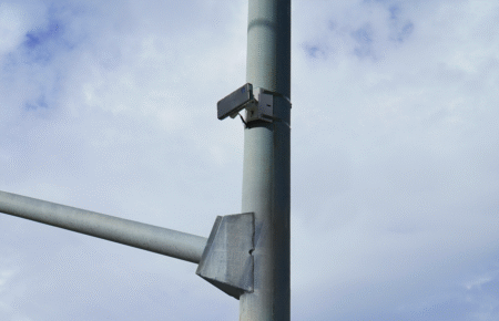
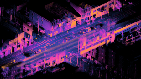
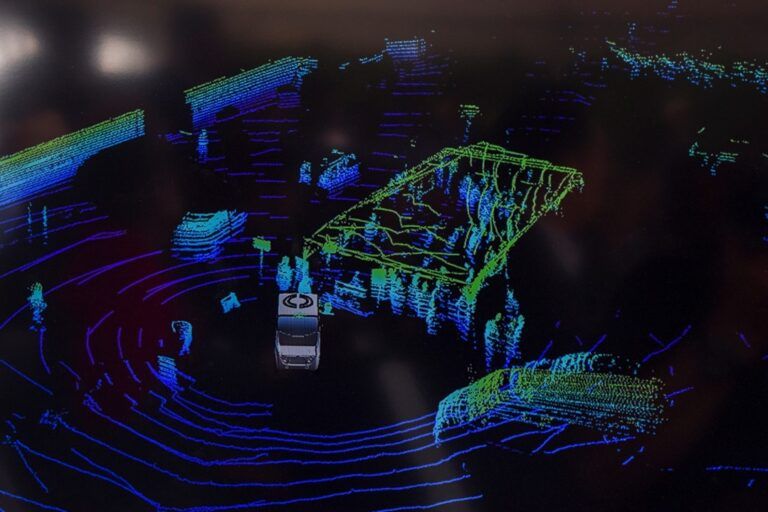
Lidar is deployed at intersections to essentially do the same job that radar and inductive loops have done for many years – telling the controller what is waiting and where. The difference is resolution and reach. A single roadside lidar unit can build a continuous three-dimensional picture of everything moving through the junction, lane by lane, several hundred feet out, by day or night. While lidar can be degraded by heavy rain and snow it outperforms video. And whereas the best radar can beat lidar in heavy weather, it can never deliver the same detail, even in perfect conditions.
“We are building the largest lidar-powered smart traffic network in the United States. Enabling optimized traffic signal management to improve traffic flow and provide data we can use to help to improve pedestrian safety”
Tim Kelly, Mayor of Chattanooga

“The big thing about lidar is you’re able to get a 3D image of everything around you and what is happening in real time,” says Mark Taylor, traffic signal operations engineer at UDOT in an interview with the American Society of Civil Engineers. “You’re able to look at things like red-light running and near misses for pedestrians and vehicles, and you’re able to see a lot more information that the traditional detector is not able to provide you with.”

Loops and radar count vehicles. Lidar understands behaviour, which means it can surface the near-miss, the split failure and the conflict hot spot before any become a crash.
“The big bonus is that lidar sees people,” says Leonard. “Radar doesn’t, because we’re not made of metal. So lidar sees people and bicyclists, and so we’re using lidar to detect pedestrians crossing the road, specifically in crosswalks.”

In Bellevue, Washington, a before-and-after evaluation of a crosswalk lidar deployment, conducted by consultant Fehr & Peers, recorded a 56% fall in pedestrian-vehicle conflicts. “It offers better detection of road users to increase safety and minimize delays,” says Bellevue’s mobility planning manager Franz Loewenherz. “It also lowers costs by eliminating the need to maintain loops.”
There is a privacy dividend too. Lidar perceives shape, position and trajectory but captures no faces and no number plates, which makes it considerably easier to deploy under data-protection regimes than video equivalents.

From pilot corner to network
The era of lidar in ITS is now well and truly upon us, and the scale of deployment is the clearest signal that something has shifted, with the numbers in Utah helping to tell the story.
“We currently have lidar on about 100 of our intersections here in the Salt Lake metro area,” says Leonard. “Our traffic signal group’s goal is to have lidar at all of our 1,600 or so state-owned intersections in the next few years, as we upgrade, replace and build new.”
Indeed, it was recently announced that Econolite has extended its contract with Utah DOT to deploy lidar at intersections across the state.
Utah is an example, but it is not alone. Chattanooga, Tennessee, working with Ouster and the University of Tennessee is building out beyond 120 intersections. “We are building the largest lidar-powered smart traffic network in the United States,” claims Mayor Tim Kelly. “Enabling optimized traffic signal management to improve traffic flow and provide data we can use to improve pedestrian safety.”

“The big bonus is that lidar sees people. Radar doesn’t, because we’re not made of metal”
Blaine Leonard transportation technology engineer, UDOT
The greater Atlanta area has over 30 lidar-equipped intersections with Georgia DOT. Meanwhile, New Jersey DOT completed a deployment across more than 40 highway locations around MetLife Stadium for the FIFA World Cup, integrated directly into the state’s traffic management system.
In June 2026, the first deployment of Ouster’s latest BlueCity sensor, adding native colour to the point cloud and detection out to 500 feet, went live in Stamford, Connecticut. Competition is healthy: Seoul Robotics powered the first intersection in the United States where the signals were controlled directly by lidar, also in Utah, while Seyond, Cepton, Velodyne, now part of Ouster, and Outsight are all active in the segment.
Replacing, or joining, the stack?
While there is technically potential for lidar to take over from other sensors, in fact the reality on the ground is more layered. Lidar is consolidating the sensor stack rather than clearing it. Vendors argue that one or two units can do the work of multiple cameras, radars and loops at a single junction, installed in a few hours without cutting the pavement. Yet deployments tend to fuse lidar with other sensors rather than rely on it alone. New Jersey’s World Cup project layers lidar, camera-based video analytics and roadside units together, and Bellevue runs lidar alongside video.
Loops remain lidar’s most obvious casualty. They wear out on a short cycle, require lane closures to install and repair, and cannot tell a lorry from a cyclist. Radar holds on through cost in some instances and robustness in heavy precipitation, with a new generation of higher-resolution radar closing the gap.
Cameras keep their place where colour, context and plate capture are needed, particularly for enforcement. What lidar offers that none of the others can match in combination is accurate three-dimensional sensing, by day or night and through conditions that blind a camera, of every road user including the unprotected ones, without recording anyone’s identity.

Joining the dots
However, the reason a traffic engineer like Leonard is so animated about lidar is not so much about traditional traffic counting and management. It is what the sensor can tell a car. Lidar’s ability to see a pedestrian that a vehicle cannot is the bridge from intersection management to vehicle-to-everything (V2X) safety, and it is here that infrastructure detection earns its keep.
“We’ve developed ways to send a V2X message into the car that might be turning right at a corner, that there’s a pedestrian in their path that they may or may not have noticed or be able to see,” Leonard explains. Around 20 of Utah’s lidar-equipped intersections already broadcast that data to vehicles, a figure the agency intends to grow.
The logic answers the standing objection from carmakers that their own sensors will eventually make roadside ones redundant. “Automated vehicles base their decisions on what the vehicle can see,” Leonard says. “V2X enables us to know things they maybe can’t see, and so I think they’re complementary. V2X can show a driver things that they can’t see that are around a corner.” However good a car’s cameras become, they cannot see through a building. The intersection can.
Blaine Leonard is a leader on the V2X project Connecting The West. For more on this and connected vehicles across the USA, don’t miss our special feature in the next edition of TTi magazine
1,600
The approximate number of intersections in Utah with planned ITS lidar deployment (currently around 100 are equipped)
The picture in Europe
Europe, for now, remains a step behind the United States in scale rather than ambition. The pilots are further along than the rollouts.
Helsinki is the standout. Through the city’s innovation company Forum Virium Helsinki, lidar from Velodyne (now part of Ouster) running Bluecity.ai perception software has monitored intersections in the Jätkäsaari district, achieving average detection accuracy of 97% across vehicles, cyclists and pedestrians, and flagging near-misses such as red-light running and jaywalking.
Crucially, one site pairs the sensor with a C-ITS roadside unit that pushes vulnerableroad- user warnings, the same infrastructure-tovehicle safety loop being built in Utah. “Velodyne Lidar has shown it can reliably and accurately generate traffic information involving vehicles, pedestrians and bicycles, including volume and classification data, directions, trajectories and speed,” says Janne Rinne, project manager at Forum Virium Helsinki. “The solution provides accurate real-time detection data to support C-ITS safety solutions like vulnerable road user warnings that can help improve road safety.”
The city sees the data doing more than triggering warnings and is also looking at it to assist in use cases such as calculating live journey times and managing pedestrian and bicycle traffic in real-time, as well as prioritising snow clearance in certain areas to promote active travel.
Elsewhere in Europe pilots are underway in Germany and the Baltics, and lidar is used in enforcement cameras from the likes of Vitronic and Parifex, but no European city has yet announced a rollout of lidar on intersections on the scale of Utah’s or Chattanooga’s, with federal funding grants via the Safe Streets, Roads for All and SMART programmes giving the US a head start.
A SHORT HISTORY OF LIDAR
Lidar, light detection and ranging, is older than it looks. The principle of timing a light pulse to measure distance dates to the early 1960s, immediately after the invention of the laser, and NASA put it to work in 1971 when Apollo 15 mapped the lunar surface from orbit. For decades it stayed a specialist instrument for surveying, meteorology and aerospace.
Its leap into transport came from the DARPA Grand Challenges of the mid-2000s, the desert races that kick-started autonomous driving. David Hall of Velodyne developed the spinning 64-beam sensor that gave a self-driving car a real-time 3D map of its surroundings, and for years that rooftop unit, costing as much as a car itself, was the face of lidar. The whole autonomous-vehicle industry was built on it.
That same automotive push is what eventually made roadside lidar affordable. The race to put lidar in cars drove a decade of investment into solid-state designs with no spinning parts, and mass manufacturing, latterly dominated by Chinese producers, collapsed the price. The sensor developed to let a car see its surroundings turned out to be just as capable bolted to a signal pole, looking down at the junction, and cheap enough to leave there permanently. The technology that grew up to help vehicles drive themselves is now, increasingly, watching over the rest of us at the intersection.