


Traffic Technology TodayTraffic Technology Today
  • News
    • A-D
      • Appointments & Staffing
      • Artificial Intelligence (AI)
      • Asset Management
      • Autonomous Vehicles & ADAS
      • Awards
      • Cloud Computing
      • Congestion Reduction
      • Connected Vehicles
      • Covid-19
      • Cybersecurity
      • Mapping, Modelling & Navigation
      • Deals, Acquisitions & Mergers
    • E-J
      • Electric vehicles & infrastructure
      • Emissions & Low Emission Zones
      • Enforcement
      • Event News
      • Funding
      • Incident Detection
      • Infrastructure
      • Intersections & Traffic Signals
      • ITS
    • K-S
      • Legal / Government Regulation
      • Machine Vision / ALPR
      • Mobility as a Service
      • Multimodality & Micromobility
      • Planning, Testing, R&D
      • Public transit
      • Safety
      • Smart Cities
      • Smart Parking
    • T-Z
      • Tolling
      • Traffic counting & categorization
      • Traffic Management
      • Traveler Information Systems
      • Variable Message Signs
      • Vulnerable Road Users
      • Weather systems
  • Features
    • Features
    • Opinion
  • Online Magazines
    • Recent Issues
    • Archive List
    • Pre-2016 Issue Archive
    • Subscribe Free!
  • Video & Audio
    • Video
    • Audio
  • Podcast
  • Events
  • Webinars
  • Technology Profiles
LinkedIn YouTube X (Twitter)
Subscribe >
Traffic Technology TodayTraffic Technology Today
  • News
      • Appointments & Staffing
      • Artificial Intelligence (AI)
      • Asset Management
      • Autonomous Vehicles & ADAS
      • Awards
      • Cloud Computing
      • Congestion Reduction
      • Connected Vehicles
      • Cybersecurity
      • Mapping, Modelling & Navigation
      • Work zones
      • Deals, Acquisitions & Mergers
      • Electric vehicles & infrastructure
      • Emissions & Low Emission Zones
      • Enforcement
      • Event News
      • Funding
      • Incident Detection
      • Infrastructure
      • Intersections & Traffic Signals
      • ITS
      • Legal / Government Regulation
      • Machine Vision / ALPR
      • Mobility as a Service
      • Multimodality & Micromobility
      • Planning, Testing, R&D
      • Public transit
      • Safety
      • Smart Cities
      • Smart Parking
      • Tolling
      • Traffic counting & categorization
      • Traffic Management
      • Traveler Information Systems
      • Variable Message Signs
      • Vulnerable Road Users
      • Weather systems
  • Features
    • Features
    • Opinion
  • Online Magazines
    1. Recent Issues
    2. Archive List
    3. Pre-2016 Issue Archive
    4. Subscribe Free!
    Featured
    April 21, 2026

    NEW ISSUE: Read the April/May 2026 edition of TTi magazine online now!

    ITS By Web Team
    Recent

    NEW ISSUE: Read the April/May 2026 edition of TTi magazine online now!

    April 21, 2026

    NEW ISSUE: Read the February/March 2026 edition of TTi magazine online now!

    February 25, 2026

    NEW ISSUE: Read the November/December 2025 edition of TTi magazine online now!

    November 30, 2025
  • Video & Audio
    • Video
    • Audio
  • Podcast
  • Events
  • Webinars
  • Technology Profiles
LinkedIn YouTube X (Twitter)
Traffic Technology TodayTraffic Technology Today
Artificial Intelligence (AI)

Esri and Here Technologies add AI analysis to GIS

Tom StoneBy Tom StoneJuly 16, 20262 Mins Read
Share LinkedIn Twitter Facebook Email
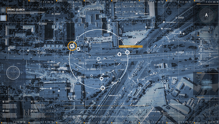
A satellite map view of a city overlaid with a digital "drone search" interface, showing coordinate grids, tracking reticles and dashed path lines
The partnership combines Here's map, traffic and mobility data with Esri's ArcGIS geospatial platform

Location data company Here Technologies and geospatial software provider Esri have signed a three-year agreement to jointly develop location-based analytics and visualisation tools designed to support artificial intelligence (AI) applications. The companies announced the deal at the Esri User Conference in San Diego, California.

The partnership combines Here’s map, traffic and mobility data with Esri’s ArcGIS platform, aiming to make live and historical geospatial data more accessible to engineering teams and AI systems working within analytics workflows.

Extending a two-decade partnership

Here and Esri have worked together for more than 20 years on projects involving location data. The companies say the new agreement builds on that relationship, with the aim of helping customers combine AI-ready geospatial analytics with their existing ArcGIS environments, reducing the complexity of integrating and operationalising location data at scale.

“For over two decades, Here has partnered with Esri to deliver trusted geospatial insights,” says Chris Handley, senior vice-president of product management at Here Technologies. “As organisations explore new AI use cases, we can help them more easily access and analyse location data, enabling faster insights and more informed decisions.”

According to Richard Cooke, corporate director of global business development at Esri, organisations are looking for analytics solutions that connect authoritative data, intuitive mapping and scalable decision support. “By bringing together HERE’s trusted location data and the analytical power of ArcGIS, we will help customers extend what they can do within existing workflows and support emerging AI applications,” he says.

A double-exposure image showing the silhouette of a woman's head in profile, overlaid with an aerial view of a city model and glowing network connection points
Here and Esri aim to make location data more accessible to AI systems and engineering teams. (Image: AdobeStock)

Target sectors include transport and logistics

The companies say the combined capabilities are intended for organisations across transportation and logistics, the public sector, automotive and high-tech industries, helping them analyse real-world movement patterns and apply the resulting insights to planning, operations and decision-making.

Built on ArcGIS, Esri’s geospatial platform, the new visualisation and analytics tools are designed to give AI systems and engineering teams access to live and historical location data, supporting what the companies describe as agentic workflows alongside conventional reporting and decision-making tasks.

New data suite underpins the partnership

The data suite underpinning the new capabilities, Here GIS Data Suite, was introduced by Here in 2025 to provide a curated dataset for ArcGIS environments. It will serve as the foundational layer for the analytics tools developed under the new agreement.


 

Share. Twitter LinkedIn Facebook Email
Previous ArticleDrivers trust road safety tech more than experts, study finds
Next Article TfL expands Lane Rental scheme to more boroughs
Tom Stone

Tom has edited Traffic Technology International (TTi) magazine and its Traffic Technology Today website since May 2014. During his time at the title, he has interviewed some of the top transportation chiefs at public agencies around the world as well as CEOs of leading multinationals and ground-breaking start-ups. Tom's earlier career saw him working on some the UK's leading consumer magazine titles. He has a law degree from the London School of Economics (LSE).

Related Posts

bald white man in suit with glasses at an expo event
Artificial Intelligence (AI)

OPINION: AI’s next mile marker is connected corridors

July 9, 20263 Mins Read
Computer monitors displaying data dashboards, structural diagrams and a National Highways-branded digital twin interface.
Artificial Intelligence (AI)

VIDEO: National Highways and Cambridge University research alliance unveils AI and digital-twin tools

July 2, 20263 Mins Read
Artificial Intelligence (AI)

ITS DETROIT VIDEO: The LLM making traffic management 100x more efficient

June 11, 20261 Min Read
Latest Posts
Road Ahead Closed" and "Diversion" signs on a City of London street, with contractors working in the background

TfL expands Lane Rental scheme to more boroughs

July 16, 2026
A satellite map view of a city overlaid with a digital "drone search" interface, showing coordinate grids, tracking reticles and dashed path lines

Esri and Here Technologies add AI analysis to GIS

July 16, 2026
A man and woman drive a red convertible along a dirt road at sunset, with the woman raising both arms in the air

Drivers trust road safety tech more than experts, study finds

July 16, 2026
FREE WEEKLY NEWS EMAIL!

Get the ‘best of the week’ from TrafficTechnologyToday.com direct to your inbox every Thursday


Supplier Spotlights
  • Conduent Transportation
    Conduent Transportation
  • Norbit ASA
    Norbit ASA
  • Teconer Oy Finland
    Teconer Oy
  • MESSAGEMAKER DISPLAYS
  • Carrida Technologies GmbH
    CARRIDA Technologies GmbH
  • triple sign system AB
    Triple Sign System AB
  • Cross Zlin
    CROSS Zlín a.s.
  • SMATS traffic solutions logo
    SMATS Traffic Solutions Inc.
  • Star Systems International Limited
Our Social Channels
  • Twitter
  • YouTube
  • LinkedIn
Getting in Touch
  • Free Email Newsletters
  • Contact Us
  • About Us
  • Supplier Spotlight

Upcoming Events

Notice
There are no upcoming events.
© Copyright 2026 Mark Allen Group. All rights are reserved, including those for text and data mining, AI training, and similar technologies.
  • Cookie Policy
  • Privacy Policy
  • Terms & Conditions

Type above and press Enter to search. Press Esc to cancel.