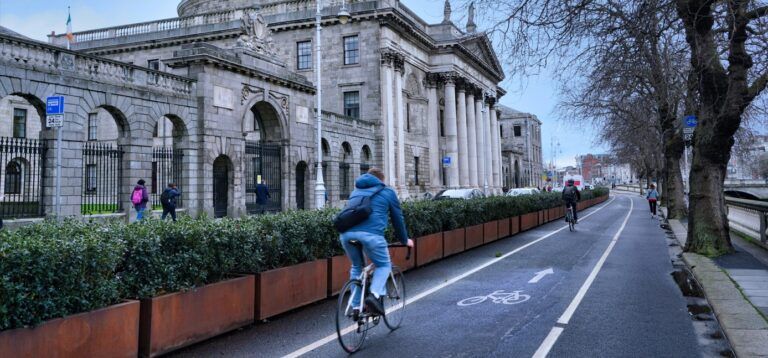
Dublin is taking a major step toward its vision of safer, greener, and more accessible streets with the creation of a city-scale AI digital twin designed to transform how transport and environmental data are used for decision-making.
The initiative brings together Smart Dublin, VivaCity, and Bentley Systems to develop a proof-of-concept platform that combines real-time sensor data, geospatial mapping, and simulation technology to support active travel and road safety across the capital and its surrounding boroughs.
Smart Dublin, an innovation program run by the four local authorities in the region, has been exploring new technologies to help achieve Dublin City Council’s ambitious goal: ensuring that every resident is within five minutes, or 500m, of a safe active travel route. The initiative reflects a shift toward evidence-based planning, where data gathered from across the transport network informs infrastructure upgrades and performance evaluation.
The new digital twin, now in its pilot phase, represents the next step in this evolution. Developed in partnership with VivaCity and Bentley Systems, it fuses live feeds from AI-powered traffic sensors with other city data sources, creating a dynamic 3D model of Dublin that updates in real time. This immersive environment allows planners to monitor conditions as they unfold and to simulate potential interventions before they are implemented on the ground.
Working together to create an end-to-end solution, Bentley Systems and VivaCity have followed the NVIDIA Blueprint for smart city AI – a framework that supports city-scale intelligence from simulation and training to deployment using video analytics AI agents. The proof-of-concept combines Bentley’s 3D geospatial platform Cesium with NVIDIA Omniverse, creating an interactive space for visualizing active travel sensor data and analyzing road-user behavior.
VivaCity’s AI traffic sensors, powered by NVIDIA Jetson and NVIDIA Metropolis, capture multimodal data on pedestrians, cyclists, and vehicles with high accuracy. These sensors also identify close passes and other safety-related interactions between road users, providing valuable insights for targeted interventions. The resulting data streams are integrated into Bentley’s digital twin environment, enabling planners to explore relationships between traffic behavior, weather, and infrastructure performance.
In addition to live sensor data, the platform incorporates information from Dublinked, the city’s open-data portal, unifying diverse datasets in a single 3D view. Traffic reports, weather readings, water levels, and geospatial data are layered over the map, offering an at-a-glance picture of how Dublin moves. Counts and metrics are color-coded to reveal patterns of activity or areas of concern, while time-series analysis tools allow planners to study long-term trends.
Although the project remains a proof of concept, early results have already revealed insights that challenge existing assumptions. By combining VivaCity’s cycling counts with rainfall data, the platform showed that rain has a negligible impact on the number of cyclists in Dublin. This finding supports further investment in cycling infrastructure by demonstrating that committed cyclists continue travelling even in poor weather.
Other data show that demand for new cycling routes is surpassing expectations. During peak hours, sensors recorded between 800 and 1,000 cyclists on the Clontarf-to-city-center route, a marked increase from pre-investment estimates. Such data has proven valuable to Dublin City Council committees, which are using the information to justify continued expansion of the city’s active-travel network. Smart Dublin has also integrated these datasets into its Active Travel Dashboard, which combines VivaCity data with information from the Irish census, Google EIE, Strava Metro, and EcoCounter.
As Jack Kavanagh, Dublin City Council’s open data lead, explained, “Our aim is that every resident is within five minutes or 500 metres of a walking or cycling route. This digital twin is for data insights so that we can measure and monitor and make better data-driven decisions. It’s the first time we’ve been able to get these insights so quickly and all in one place. This pilot project is really exciting and best positions the Dublin region to address the future urban challenges that arise in keeping active travel safe and accessible for all.”
Mark Nicholson, VivaCity’s CEO, added: “Collaborating with Dublin, Bentley, and NVIDIA on this digital-twin and AI agent initiative is incredibly exciting for us. We believe our highly accurate sensor data is the perfect match for the city’s integrated platform, and it’s already delivering insights that can help understand and impact how Dublin moves. We’re looking forward to continuing supporting the Smart Dublin team to unlock more insights from the data and enable safer and more sustainable journeys for everyone.”
The proof of concept will be showcased at the Smart City Expo World Congress 2025 in Barcelona, where it will feature in the City of Dublin booth. If successful, the project could become a model for other cities worldwide, demonstrating how AI-enabled sensors, open data, and collaborative platforms can help create safer streets and encourage healthier, more sustainable urban mobility.


