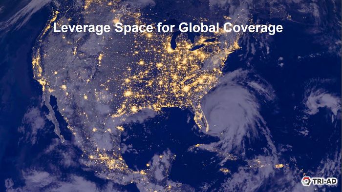
Toyota is leading a new partnership that will develop a system to create automated high-definition (HD) maps for connected and autonomous vehicles (CAVs) using high-resolution satellite imagery.
Toyota’s automated driving software development company, Toyota Research Institute-Advanced Development, Inc. (TRI-AD), is partnering with Maxar Technologies Inc., a global technology innovator powering the new space economy, and leading IT services provider NTT DATA Corporation to collaborate on a proof-of-concept (POC) building HD maps using photographs from space.
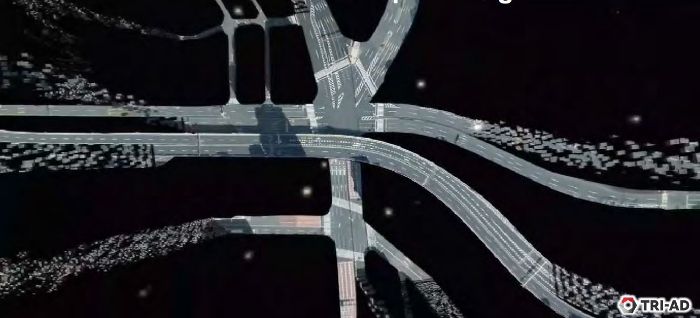
 The project is an important move toward advancing TRI-AD’s open software platform concept known as Automated Mapping Platform (AMP) and will help realize the scalability of autonomous driving. CAVs use several real-time sensors to ensure safe driving and these sensors need to be cross-referenced with an HD map for safe operation.
According to TRI-AD analysis, currently HD maps cover less than 1% of the 24,500,000 miles (39,500,000km) global road network, and there is a need to broaden the coverage of urban areas and local roads before self-driving vehicles can become a mainstream mobility technology. An HD map created from the accurate satellite imagery allows the driving software to compare multiple data sources and signal the car to take action to stay safe.
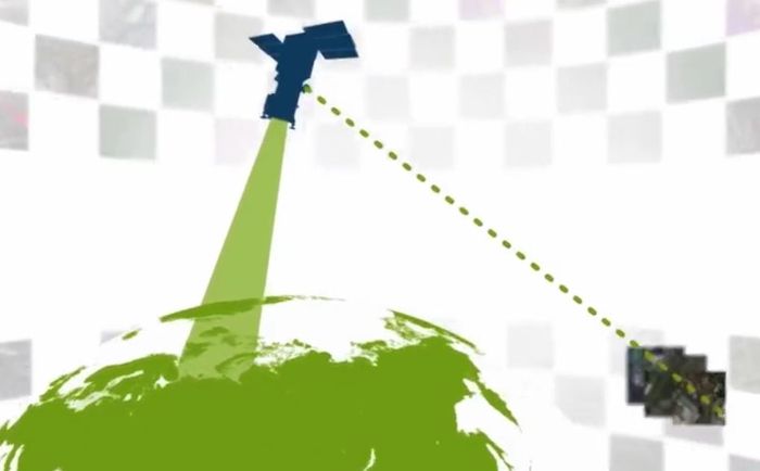
 In the POC project, the three companies will work together to process satellite imagery into vehicle-friendly HD maps. Making use of Maxar’s cloud-based Geospatial Big Data platform (GBDX), imagery from Maxar’s optical satellite imagery library will be fed into NTT DATA’s specialized algorithms using artificial intelligence (AI) to extract information that is necessary to generate the detailed road network.
Based on the above information, TRI-AD will make HD maps available for delivery from the company’s cloud servers into Toyota test vehicles. The group is focusing first on creating an automated HD map for a predefined area of the Tokyo metropolitan region, opening up the future possibility of supporting automated mobility on all roads worldwide.
 “Recent advances in electronics and aerospace engineering are leading to higher resolutions and more frequent updates of global imagery from space-based assets,” noted Mandali Khalesi, vice president of automated driving at TRI-AD. “Additionally, machine learning is helping automate the discovery and integration of semantic relationships between road elements within image data. We’re excited to collaborate with Maxar and NTT DATA to revolutionize automated driving mobility for all.”
Paul Granito, Maxar’s VP of global sales, commented, “High-definition maps are an essential element for the navigation and safety of autonomous vehicles, and we are proud to provide the data and analytics platform that make HD maps possible. This new, innovative project points to the growing demand of our exclusive high-resolution imagery and advanced geospatial analytics.”
 Katsuichi Sonoda, head of NTT DATA’s social infrastructure solution sector, added, “We have been fully engaged in the satellite-imaging business for 20 years, providing our AW3D-branded 3D maps on a global short-delivery basis. In this new project, we will use our AI and enhanced image-processing expertise to expand the coverage of high-definition maps on a fast, scalable and cost-effective basis. In the future, we hope to map worldwide road networks from space using our enhanced image-processing expertise.”