


Pay-per-mile tolling using satellites is under close scrutiny – it’s already in use for trucks in Europe and pilots for cars are underway, it is an option for road user charging (RUC) subscribers in Oregon, and Singapore is poised to switch its cordon-based congestion charging to a GNSS system (with RUC capability built in) later this year. Christopher Court-Dobson investigates the challenges and benefits of such systems and asks, how far can we go?
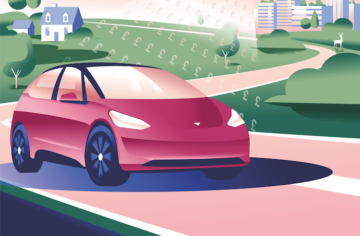
Global Navigation Satellite Systems (GNSS) are tipped as the go-to technology for RUC (road user charging) at a time when there is increased interest in pay-per-mile from policymakers across the globe, due to the pressing need to replace falling fuel tax revenues as EVs accelerate in popularity.
Two GNSS-based pilot schemes for distance-based charging have recently gone live Munich and Barcelona, as part of a package to reduce congestion and air pollution. Currently experts from Abertis Mobility Solutions and its subsidiary Emovis, who are overseeing the pilot, are remaining tight-lipped about process and outcomes, but some official results are expected before the end of the year. That doesn’t mean satellite-based tolling hasn’t already been proven to work – it is operating at the whole-nation level for heavy goods vehicles (HGVs) in eight European countries, and therefore has the potential to eventually be implemented as comprehensive RUC for all road users in the future.
Roadside solutions?
Electronic tolling has been in operation now for many years, using roadside technologies such as ALPR, DSRC and RFID. These all have certain advantages, but none are especially well suited to charging by the mile across an entire network. DSRC requires an on-board unit (OBU) installed in the vehicle, which communicates with gantries. RFID, while low cost and low maintenance for users, is less secure, requiring the co-use of ALPR for safeguarding. There are also concerns that bad actors with ‘rogue’ readers could gain access to the vehicle data and that tags can be cloned
In RUC pilots in the USA a variety of new technologies have been trialed to charge road users for every mile they travel, including dedicated OBUs to record mileage, self-reported odometer readings and smartphone apps. What has become clear from these trials is that it is technology linked to satellite positioning that is the most suited for efficient RUC.

Eyes in the skies
It’s common to refer to all smartphone and satnav location systems as GPS, but this is not strictly accurate. What is thought of as Global Positioning System (GPS) is the name given by the United States Space Force to its GNSS system. China’s BeiDou, Russia’s GLONASS, and Europe’s Galileo are the other major satellite constellations, and many devices are today multi-GNSS. There is also the Quasi-Zenith Satellite System (QZSS) built by Japan to enhance the accuracy of the GPS constellation in the Asia-Oceania region.
Geolocation is ubiquitous in smartphones and tablets, so it has increasingly made sense that RUC would hinge on this technology. When the app or OBU derives its location data from the satellite constellation, it sends the data via the cellular network to proxy servers and then to the toll system back office, which can collate and process the data, and then pass it onto the charging and payment system.
“The only major limitationis the level of complexity that the end user will accept”
Justin Hamilton, director of location-based charging at, Kapsch TraffiCom
Once the satellite GNSS has been used to produce a geolocation, any other available data can be collated in order to calculate a specific price for that specific mile, incorporating vehicle class, fuel type and time of day. The level of detail it is possible to extract, which enables this dynamic pricing flexibility, makes GNSS-based RUC far superior to alternatives such as simple odometer readings. “The approach is very flexible, and the only major limitation is the level of complexity that the end user will accept in such a system,” says Justin Hamilton, who is director of location based charging at Kapsch TraffiCom.
Seeing every road
So, what are the other advantages of GNSS? Whereas roadside approaches can only detect a vehicle at the point where the infrastructure is installed, GNSS will pinpoint the location to within two meters anywhere in its zone of operation.
“For GNSS-based tolling, two-meter accuracy is usually more than enough, and all modern GNSS chipsets can easily manage this. If you spend a bit more for multi-frequency chipsets you can achieve one-meter accuracy in urban environments,” says Norbert Schindler, CEO of GNSS Consulting.
This makes it particularly crucial to ‘whole-nation’ coverage, where pay-per-mile RUC is in operation throughout the entire road network, rather than just for specific areas such as city-centers or particular stretches of highway.
Schindler is quietly confident about the technology’s future. “Satellite-based positioning being used for tolling and road pricing has grown significantly,” he says. “We have now eight countries in Europe that use this technology for nationwide schemes, three countries are currently procuring sub schemes, although currently charges are only focused on trucks.”
One of the major differences between roadside and GNSS is that satellite leverages existing infrastructure and, if the app based approach is taken, requires no additional equipment. By contrast, roadside is standalone, dedicated and built for purpose with the additional costs and maintenance that incurs.

From Europe to Singapore
Poland upgraded its HGV tolling solution from the DSRC based viaTOLL to its GNSS based e-Toll in 2021, and after a period of operating in parallel, seamlessly shifted to the new system. The HGV road user has the option of either an OBU, an app-based service (e-Toll PL via smartphone or tablet), or a standalone GPS unit known as an external localization system (ELS), manufactured and sold by licensed operators.
In Singapore, the island city-state is poised for full adoption of GNSS for its electronic road pricing (ERP) system. However, it has met with significant delays. Mitsubishi Heavy Industries was contracted to deliver ERP2 for 2019, but cited the global chip shortage as a reason for the standstill. It is expected to be online later this year. In its early days, ERP2 will not be pay-per-mile, but it is built with distance-based capability for the future.
ERP2 reportedly comes with an advanced multi-feature OBU which not only sends location data but also has a large touchscreen which will act as full satnav, while displaying price data for roads in the city and real-time safety alerts. It also incorporates the charging system, using contactless card payment or e-payment. However, public feedback is that the units are too bulky, and smartphone-apps are being considered for the next generation.
Singapore’s former Transport Minister Liu Tuck Yew says the focus on RUC is due to the impossibility of building more road infrastructure on the already packed island.

“Governments are promoting EVs, But the consequence will be a fall in fuel duty”
Sir Stephen Glaister, CBE
For those about to RUC
One of the major challenges for transport policymakers is fostering a smooth and rapid transition to electric vehicles without being waylaid by fiscal issues. RUC is tipped as a solution, one which has the flexibility to maintain an economic incentive for EV use, while filling the fiscal black hole.
“Fuel duty raises about 30 billion a year. It is one of the biggest sources of excise tax for the government. Big money,” says Sir Stephen Glaister, CBE, professor emeritus for transport and infrastructure at Imperial College, London, and former chair of the RAC, and a board member of Transport for London.
In the UK fuel tax revenue dipped during the lockdown years, and has never returned to pre-pandemic levels. “So, the government has got a problem,” continues Glaister. “It is promoting electric vehicles and efficiency, quite rightly. But the consequence of that will be a fall in fuel duty. The Treasury has to decide whether it’s going to allow that to happen.”
There’s also the issue of congestion in urban areas, along with attendant air pollution and its impacts on public health. “Are we going to let it get worse? It’s an option,” says Glasiter. “Or do we do something more sensible, such as changing policy to stop the growth of traffic.”
Experts indicate the obstacles to RUC are not technologicical, but a question of public acceptance. Satellite tolling really is ready to RUC, but is the general road user?
“A change like that, even if you did it on a small scale would need a lot of explaining to the public and a very careful public relations campaign,” says Glasiter. “But there’s a lot of evidence actually that, whereas people always oppose these ideas, because they find them hard to understand and they’re very difficult to explain, once they have been introduced they see the benefit.”
This feature was first published in the September 2023 edition of TTi magazine


