Traffic Technology TodayTraffic Technology Today
  • News
    • A-D
      • Appointments & Staffing
      • Asset Management
      • Autonomous Vehicles & ADAS
      • Awards
      • Cloud Computing
      • Congestion Reduction
      • Connected Vehicles
      • Covid-19
      • Cybersecurity
      • Data & Modeling
      • Deals, Acquisitions & Mergers
    • E-J
      • Electric vehicles & infrastructure
      • Emissions & Low Emission Zones
      • Enforcement
      • Event News
      • Funding
      • Incident Detection
      • Infrastructure
      • Intersections & Traffic Signals
      • ITS
    • K-S
      • Legal / Government Regulation
      • Machine Vision / ALPR
      • Mapping
      • Mobility as a Service
      • Multimodality & Micromobility
      • Planning, Testing, R&D
      • Public transit
      • Safety
      • Smart Cities
      • Smart Parking
    • T-Z
      • Tolling
      • Traffic counting & categorization
      • Traffic Management
      • Traveler Information Systems
      • Tunnels & Bridges
      • Variable Message Signs
      • Vulnerable Road Users
      • Weather systems
  • Features
    • Features
    • Opinion
  • Online Magazines
    • May 2025
    • March 2025
    • December 2024
    • September 2024
    • June 2024
    • Archive Issues
    • Subscribe Free!
    • > Tolltrans
  • Video & Audio
    • Video
    • Audio
  • Podcast
  • Events
  • Webinars
  • Technology Profiles
LinkedIn YouTube X (Twitter)
Subscribe >
Traffic Technology TodayTraffic Technology Today
  • News
      • Appointments & Staffing
      • Asset Management
      • Autonomous Vehicles & ADAS
      • Awards
      • Cloud Computing
      • Congestion Reduction
      • Connected Vehicles
      • Covid-19
      • Cybersecurity
      • Data & Modeling
      • Deals, Acquisitions & Mergers
      • Electric vehicles & infrastructure
      • Emissions & Low Emission Zones
      • Enforcement
      • Event News
      • Funding
      • Incident Detection
      • Infrastructure
      • Intersections & Traffic Signals
      • ITS
      • Legal / Government Regulation
      • Machine Vision / ALPR
      • Mapping
      • Mobility as a Service
      • Multimodality & Micromobility
      • Planning, Testing, R&D
      • Public transit
      • Safety
      • Smart Cities
      • Smart Parking
      • Tolling
      • Traffic counting & categorization
      • Traffic Management
      • Traveler Information Systems
      • Tunnels & Bridges
      • Variable Message Signs
      • Vulnerable Road Users
      • Weather systems
  • Features
    • Features
    • Opinion
  • Online Magazines
    1. May 2025
    2. March 2025
    3. December 2024
    4. September 2024
    5. June 2024
    6. March 2024
    7. Archive Issues
    8. Subscribe Free!
    9. > Tolltrans
    Featured
    New issue graphic
    May 7, 2025

    Read the new TTi digital magazine online now – May 2025

    ITS By Tom Stone
    Recent
    New issue graphic

    Read the new TTi digital magazine online now – May 2025

    May 7, 2025

    NEW TTi MAGAZINE! Read the March 2025 digital edition online now

    March 21, 2025

    Digital magazine – read the new issue of TTi online for free – December 2024

    December 12, 2024
  • Video & Audio
    • Video
    • Audio
  • Podcast
  • Events
  • Webinars
  • Technology Profiles
LinkedIn YouTube X (Twitter)
Traffic Technology TodayTraffic Technology Today
Environment & Emissions

EarthSense’s UK air quality data now available on Esri’s ArcGIS Marketplace

Tom StoneBy Tom StoneFebruary 24, 20223 Mins Read
Share LinkedIn Twitter Facebook Email

EarthSense, the air quality specialist, has announced that its latest MappAir annual average datasets are now available to purchase through Esri’s ArcGIS Marketplace, enhancing the mapping and location analytics platform.

The addition of MappAir annual average data to Esri’s ArcGIS Marketplace enables organisations such as local authorities, construction companies, transport professionals and educational facilities to identify the average concentrations of nitrogen dioxide (NO2), particulate matter (PM2.5, PM10), sulphur dioxide (SO2) and ozone (O3) between 2018 and 2019.

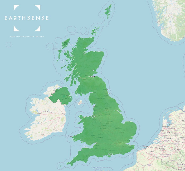
Based on measurements from EarthSense’s Zephyr air quality monitoring network, transport data and monitoring data from the Department of Environment, Food and Rural Affairs (DEFRA)’s Automatic Urban and Rural Network (AURN), the 2018 – 2019 annual average dataset provides information for the latest available date range. The data provides insight into air pollution exposure across the whole of the United Kingdom or specific locations at a 100-metre resolution.

MappAir annual average datasets can be used for investigating the number of schools, GP surgeries and hospitals located in areas with unsafe air quality. Using the data, teachers, healthcare workers and members of local councils can correlate the effects of long-term air pollution exposure with various social metrics, such as the number of hospital admissions, school attendance rates and social deprivation.

Modelled data can also be used for understanding how air pollution is affecting whole cities for planning and developing future infrastructure to encourage active travel, reduce congestion and subsequently, improve air quality.

EarthSense’s annual average data can also be integrated with existing systems and services via an application programming interface (API) to enable individuals to enter their postcodes and identify air quality levels at their homes.

Managing director at EarthSense, Tom Hall says: “Data should be driving decisions about how councils and businesses improve air quality. By adding our MappAir 2018 – 2019 annual average datasets to Esri’s ArcGIS Marketplace, we’re providing the crucial evidence needed to answer questions about where unsafe air pollution exposure is happening, who is being affected and what can be done to minimise the health and environmental related risks.

“Our relationship with Esri UK also enables us to make air quality data even more accessible to businesses who can help to create momentous changes to ambient air pollution and the safety of our world.”

Mike Forster, head of content at Esri UK said: “Minimising pollution is a key outcome of actions to achieve Net Zero. MappAir air quality data from EarthSense will enable transport, construction, and government organisations to monitor air quality effectively within ArcGIS and make informed decisions to reduce pollution. We welcome this addition to the growing range of environmental monitoring data provided by Esri UK partners through the ArcGIS Marketplace.”

EarthSense’s air pollution model, MappAir, delivers near real-time (NRT), historic and up to 72 hourly forecast data of air quality on a global, national and city resolution. Annual average data accuracy is within and compliant with the limits outlined within The Air Quality Directive (2008/50/EC) Guidelines, helping to provide an accurate and complete picture of previous air quality for evidencing and driving future decisions.

Share. Twitter LinkedIn Facebook Email
Previous ArticleNew TfL data shows success of innovative pedestrian priority traffic signals trial
Next Article UK’s drink driving epidemic continues unchecked, new figures reveal
Tom Stone

Tom has edited Traffic Technology International (TTi) magazine and its Traffic Technology Today website since May 2014. During his time at the title, he has interviewed some of the top transportation chiefs at public agencies around the world as well as CEOs of leading multinationals and ground-breaking start-ups. Tom's earlier career saw him working on some the UK's leading consumer magazine titles. He has a law degree from the London School of Economics (LSE).

Related Posts

Environment & Emissions

Adept Live Labs 2 launches pledge to drive decarbonisation across UK highways

May 7, 20253 Mins Read
Environment & Emissions

London’s new Silvertown tunnel closed due to bicycle protest

April 30, 20253 Mins Read
A road at Mam Tor, Peak District National Park, UK
Environment & Emissions

NEW REPORT: Strategies for decarbonising local roads by UK’s Adept Live Labs 2

April 24, 20252 Mins Read
Latest Posts
New issue graphic

Read the new TTi digital magazine online now – May 2025

May 7, 2025

Adept Live Labs 2 launches pledge to drive decarbonisation across UK highways

May 7, 2025

AUDIO: What is distracted driving?

May 7, 2025
FREE WEEKLY NEWS EMAIL!

Get the ‘best of the week’ from TrafficTechnologyToday.com direct to your inbox every Thursday


Supplier Spotlights
Our Social Channels
  • Twitter
  • YouTube
  • LinkedIn
Getting in Touch
  • Free Email Newsletters
  • Contact Us
  • Meet the Editors
  • Supplier Spotlight

Upcoming Events

May 19
May 19 - May 21

ITS European Congress – Seville 2025

May 21
May 21 - May 22

Traffex

Jun 17
June 17 - June 19

Intertraffic Americas – Mexico City 2025

View Calendar
© 2023 Mark Allen Group Ltd | All Rights Reserved
  • Cookie Policy
  • Privacy Policy
  • Terms & Conditions

Type above and press Enter to search. Press Esc to cancel.